GEOGRAPHY PAPER 2 GRADE 12 QUESTIONS - NSC PAST PAPERS AND MEMOS FEBRUARY/MARCH 2018
Share via Whatsapp Join our WhatsApp Group Join our Telegram GroupGEOGRAPHY
PAPER 2
GRADE 12
NSC PAST PAPERS AND MEMOS
FEBRUARY/MARCH 2018
RESOURCE MATERIAL
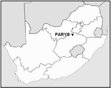
- An extract from topographical map 2627CD PARYS.
- Orthophoto map 2627 CD 19 PARYS.
- NOTE: The resource material must be collected by schools for their own use.
INSTRUCTIONS AND INFORMATION
- Write your EXAMINATION NUMBER and CENTRE NUMBER in the spaces on the cover page.
- Answer ALL the questions in the spaces provided in this question paper.
- You are provided with a 1 : 50 000 topographical map (2627CD PARYS) and an orthophoto map (2627 CD 19 PARYS) of a part of the mapped area.
- You must hand the topographical map and the orthophoto map to the invigilator at the end of this examination session.
- You may use the blank page at the back of this question paper for all rough work and calculations. Do NOT detach this page from the question paper.
- Show ALL calculations and use supplied formulae, where applicable. Marks will be allocated for these.
- Indicate the correct unit of measurement in the final answer of calculations. NO marks will be allocated for answers with incorrect units.
- You may use a non-programmable calculator and a magnifying glass.
- The area demarcated in RED on the topographic map represents the area covered by the orthophoto map.
- The following English terms and their Afrikaans translations are shown on the topographical map:
ENGLISH- Aerodrome
- Caravan Park
- Diggings
- Golf Course
- Gap
- Holiday Resort
- Island
- Purification Plant
- River
- Sewage Works
- Woodlands
QUESTIONS
GENERAL INFORMATION ON PARYS Parys is a town in the Free State in South Africa. It is located on the banks of the Vaal River approximately 115 km south of Johannesburg. The completion of the railway line to Parys in 1905 suddenly made Parys more accessible to the public and this, in turn, led to the growth of the town as a holiday resort and industrial centre. Many artists have settled in the town and the variety of new, interesting shops and attractions make it the ideal breakaway from Gauteng and other big centres. Parys lies within the Vredefort Dome World Heritage Site. The Vredefort Crater is the largest verified impact crater on Earth. The Vredefort Dome was added to the list of UNESCO World Heritage Sites for its geological interest.
Coordinates: 26°54'S 27°27'E [Adapted from http://en.wikipedia.org/wiki/Parys, South Africa, Freestate] |
QUESTION 1: MULTIPLE-CHOICE QUESTIONS
The questions below are based on the 1 : 50 000 topographical map (2627CD PARYS), as well as the orthophoto map of a part of the mapped area. Various options are provided as possible answers to the following questions. Choose the answer and write only the letter (A–D) in the block next to each question.
1.1 The provincial border found on the topographical map separates the Free State and …
- Northern Cape.
- Gauteng.
- KwaZulu-Natal.
- Mpumalanga.
1.2 The topographical map index south-east of Parys is …
- 2727AB. 2
- 727AD.
- 2627DC.
- 2727BA.
1.3 The difference in height between trigonometrical station 99 and spot height 1532 in block B9 is … metres.
- 1 433
- 1 685,3
- 153,3
- 1 532
1.4 The true bearing of the windpump in block F4 from spot height 1474 in block E6 is …
- 120°
- 240°
- 60°
- 200°
1.5 The general direction in which the non-perennial stream flows in block J8 is …
- south.
- east.
- north.
- west.
1.6 The grid reference/coordinates of the excavations in block J5 is …
- 26°56ʹ42ʺE 27°24ʹ30ʺS/26°56,7ʹE 27°24,5ʹS.
- 26°56ʹ30ʺS 27°24ʹ42ʺE/26°56,5ʹS 27°24,7ʹE.
- 26°56ʹ42ʺS 27°24ʹ30ʺE/26°56,7ʹS 27°24,5ʹE.
- 26°56ʹ30ʺE 27°24ʹ42ʺS/26°56,5ʹE 27°24,7ʹS.
1.7 The area at P in block H7 has a higher temperature than area Q in block J3 due to the …
- artificial surfaces.
- aspect of slope.
- thermal belt.
- river's influence.
1.8 The major primary activity in the mapped area is …
- mining.
- forestry.
- fishing.
- farming.
1.9 The landform indicated by line 8 on the orthophoto map is a …
- gorge.
- spur.
- valley.
- poort.
1.10 The national highway (N1) becomes … Street where it passes through the town of Parys.
- Sciffier
- Allenby
- Breë
- Eike
1.11 The man-made feature at 10 on the orthophoto map is a/an …
- mine dump.
- excavation.
- dam.
- quarry.
1.12 The main reason for the linear-shaped settlement at S in block I5 is the …
- road.
- fence.
- boundary.
- river.
1.13 Parys can be regarded as a/an … settlement.
- mining
- gap
- educational
- bridge
1.14 The drainage pattern in block J3 is a … pattern.
- trellis
- dendritic
- rectangular
- radial
1.15 Where the stream in block J8 flows into the dam at X, it is a …-order stream.
- first
- second
- third
- fourth (15 x 1) [15]
QUESTION 2: MAP CALCULATIONS AND TECHNIQUES
2.1 Calculate, in km2, the area highlighted in RED on the topographical map, which indicates the area covered by the orthophoto map. Show ALL calculations. Marks will be awarded for calculations.
Formula: Area =length ×breadth
(5 x 1) (5)
2.2 Refer to lines 11–12 on the orthophoto map, which loosely follow a hiking trail.
2.2.1 Calculate the average gradient between 11–12. Show ALL calculations. Marks will be awarded for calculations.
Formula: Gradient = vertical interval (VI)
horizontal equivalent (HE) (5 x 1) (5)
2.2.2 Give evidence from the orthophoto map to show that the average gradient calculated in QUESTION 2.2.1 is NOT a true reflection of the real landscape. (2 x 1) (2)
2.2.3 The hiking trail is recommended for novice (first-time) hikers. Give ONE reason evident in your answer to QUESTION 2.2.1 to support this statement. (1 x 1) (1)
2.3 Refer to the information about the magnetic declination of Parys found on the topographical map.
2.3.1 Calculate the magnetic declination of Parys for 2018. Show ALL calculations. Marks will be awarded for calculations.
Difference in years: ______________________________________
Mean annual change: ______________________________________
Total change: ______________________________________
Magnetic declination for 2018: ______________________________ (5 x 1) (5)
2.3.2 Compare the magnetic declination for 2018 to the magnetic declination for 2011 and indicate which one is bigger. (1 x 1) (1)
2.3.3 Give ONE reason for your answer to QUESTION 2.3.2. (1 x 1) (1) [20]
QUESTION 3: APPLICATION AND INTERPRETATION
3.1 Refer to block B2.
3.1.1 State the climatological factor that affected the location of the woodlands (plantation) in block B2 (1 x 1) (1)
3.1.2 Explain how the climatological factor stated in QUESTION 3.1.1 benefits the growth of the trees in the woodlands. (2 x 2) (4)
3.1.3 Evaluate how topography influenced the location of the woodlands in block B2. (1 x 2) (2)
3.2 Refer to the meander and slopes 13 and 14 on the orthophoto map. 3.2.1 Name the slopes of meanders 13 and 14 respectively.
Slope 13: ________________________________________________
Slope 14: ________________________________________________ (2 x 1) (2)
3.2.2 Explain how slope 13 could have increased the size of Grooteiland. (1 x 2) (2)
3.2.3 Discuss why the geomorphological activity at slope 14 may cause the inhabitants of the settlements along the river to take precautionary measures to protect their properties in the future. (1 x 2) (2)
3.3 Refer to the street patterns at P and at T in blocks H7 and I9.
3.3.1 Name the predominant street patterns at P and T.
P: ______________________________________________________
T: ______________________________________________________ (2 x 1) (2)
3.3.2 Would area P or area T experience more traffic congestion? Give a reason for your answer.
Answer: _________________________________________________
Reason: _________________________________________________ (1 + 2) (3)
3.4 Refer to blocks E1, F1 and F2 on the topographical map. Explain the role of the trees found along the banks of the Vaal River. (1 x 2) (2)
3.5 The Vredefort Dome and Crater are tourist attractions associated with the town of Parys. Evaluate the positive economic impact of the Vredefort Dome and Crater on the economy of Parys. (2 x 2) (4)
3.6 Refer to industrial area U in block I8.
3.6.1 Is industrial area U a heavy or light industrial zone? (1 x 1) (1)
3.6.2 Give ONE reason for your answer to QUESTION 3.6.1. (1 x 1) (1) [25]
QUESTION 4: GEOGRAPHICAL INFORMATION SYSTEMS (GIS)
4.1 Refer to the protected area in block H7.
4.1.1 Is the process during which an area is demarcated known as data layering or buffering? (1 x 1) (1)
4.1.2 Give reasons, evident on the topographical map, for the location of the protected area. (2 x 2) (4)
4.2 Attribute data provides useful information in a GIS.
4.2.1 Define the term attribute data. (1 x 1) (1)
4.2.2 Discuss TWO attributes that influenced the location of the hospital in block G9. (2 x 2) (4)
4.3 Refer to the orthophoto map.
4.3.1 The orthophoto map has a medium resolution. Does this mean that the orthophoto map has a high level of clarity? (1 x 1) (1)
4.3.2 Explain your answer to QUESTION 4.3.1. (1 x 2) (2)
4.3.3 Suggest ways in which data manipulation can improve the quality of the orthophoto map. (1 x 2) (2)
[15]
TOTAL: 75