GEOGRAPHY GRADE 12 PAPER 1 MEMORANDUM - NSC PAST PAPERS AND MEMOS SEPTEMBER 2017
Share via Whatsapp Join our WhatsApp Group Join our Telegram GroupGEOGRAPHY
GRADE 12
PAPER 1
NSC PAST PAPERS AND MEMOS
SEPTEMBER 2017
MEMORANDUM
SECTION A: CLIMATE, WEATHER AND GEOMORPHOLOGY
QUESTION 1
1.1
1.1.1 C (off shore) ✔
1.1.2 D (1012) ✔
1.1.3 B ![]() ✔
✔
1.1.4 A (Winter) ✔
1.1.5 D (southwest) ✔
1.1.6 B (weaker) ✔
1.1.7 C (southeast) ✔ (7 x 1) (7)
1.2
1.2.1 Confluence ✔
1.2.2 Interfluve ✔
1.2.3 Water table ✔
1.2.4 River system ✔
1.2.5 Watershed ✔
1.2.6 Abstraction ✔
1.2.7 Stream orders ✔
1.2.8 Infiltration ✔ (8 x 1) (8)
1.3
1.3.1
- Warm moist air. ✔
- Ocean temperatures above 26,5 °C. ✔ (2 x 1) (2)
1.3.2
- A – Eye ✔
B – Eye wall ✔ (2 x 1) (2) - The air is descending at A, and rising/ascending at B. ✔✔ (1 x 2) (2)
- A – High pressure in the upper layers of the atmosphere is causing some of the air to descend. ✔
B – Convergence of air on the surface because of low pressure is forcing the air to rise. ✔ (2 x 1) (2)
1.3.3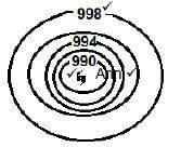
- 1 mark for air pressure below 1 000 hPa
- 1 mark for name
- 1 mark for sign of the eye (3 x 1) (3)
1.3.4
- Fishing industry will suffer because the boats cannot go out to sea ✔✔
- Harbour will be destroyed and repairs will have to be done ✔✔
- Businesses and Industries will suffer severe losses ✔✔
- Property and Infrastructure will be damaged ✔✔
- Tourism industry will suffer loses ✔✔
- Flooding will have a negative ripple effect on farming ✔✔
- Destruction will lead to unemployment ✔✔
(Any TWO) (2 x 2) (4)
1.4
1.4.1 Temperature inversion ✔ (1 x 1) (1)
1.4.2
- During clear, windless nights, air on the high grounds at the sides of the valley, cools down ✔✔
This is due to terrestrial radiation ✔✔
Cold air drains down the slopes and accumulates at the valley bottom, ✔✔ forcing warmer air to rise ✔✔
The rising warm air forms a thermal belt midway up the valley ✔✔
This causes a temperature inversion layer, where temperature increases with height ✔✔ (Any TWO) (2 x 2) (4)
1.4.3Slope A is in the shadow zone and therefore experience less evaporation, with the moisture content of the soil higher encouraging faster and lusher growth of vegetation. ✔✔ (1 x 2) (2)
1.4.4 Reasons for the temperature at B
- Sunrays strike the area more slanted/obliquely, therefore less heating during the day ✔✔
- Larger area to be heated ✔✔
- Sunrays penetrates a denser atmospheric layer causing more heat to be absorbed or dispersed, before it reaches the slope, therefore less heating ✔✔
- Katabatic flow during the night causes cold air to accumulate on the valley floor
- Temperatures drop to below freezing point (0 °C) ✔✔
Influence on crops - Oranges are frost resistant, therefore they are grown on the valley floor where cold air accumulates ✔✔
(Any FOUR – BOTH REASONS FOR TEMPERATURE AND INFLUENCE ON CROPS MUST BE MENTIONED.) (4 x 2) (8)
1.5
1.5.1 The manner in which the streams are arranged in a particular drainage basin. ✔ (Concept) (1 x 1) (1)
1.5.2
- – Rectangular ✔
- – Trellis ✔ (2 x 1) (2)
1.5.3
- – The mainstream and its tributaries have right angled bends ✔✔
- – The mainstream flows in a valley area and the tributaries join the mainstream at right angles from a high lying area. ✔✔ (2 x 2) (4)
1.5.4
- Developed due to underlying horizontally layered igneous rocks which has cracked or jointed. ✔✔
- The cracks and joints are exposed to erosion, and the water from stream/river will flow/incise along the cracks and joints. ✔✔ (2 x 2) (4)
1.5.5
- – Hard resistant rocks are causing less channels to be eroded and fewer streams in the basin will result in low density. ✔✔
- – Softer less resistant rocks can easily be eroded as a result more channels are created for stream flow and higher drainage density is the result. ✔✔ (2 x 2) (4)
1.6
1.6.1 Upper course ✔ (1 x 1) (1)
1.6.2 Narrow ✔ (1 x 1) (1)
1.6.3
- Turbulent ✔ (1 x 1) (1)
- Resistant layer or outcrop is dipping upstream. ✔✔
The bedrock upstream and downstream is less resistant and is easily eroded, exposing the outcrop. ✔✔
The slope created on the more resistant bedrock is causing the stream water to flow faster. ✔✔
(Any TWO) (2 x 2) (4)
1.6.4
- In the upper course of the river, there will be downward erosion and deep, V-shaped valleys occurs. ✔✔
- Temporary base levels of erosion like rapids and waterfalls will be eroded away through headward erosion. ✔✔
- In the middle course lateral erosion dominates. ✔✔
- This will widen the river valley and will remove the remaining spurs and other high lying areas. ✔✔
- The lower course is dominated by deposition. ✔✔
- The area is relatively flat in the lower course and this gentle gradient is maintained through deposition. ✔✔
(Any FOUR) (4 x 2) (8)
[75]
QUESTION 2
2.1
2.1.1 B to A ✔
2.1.2 B ✔
2.1.3 A ✔
2.1.4 A ✔
2.1.5 B ✔
2.1.6 A ✔
2.1.7 B ✔
2.1.8 A ✔ (8 x 1) (8)
2.2
2.2.1 Laminar ✔
2.2.2 Turbulent ✔
2.2.3 Turbulent ✔
2.2.4 Laminar ✔
2.2.5 Turbulent ✔
2.2.6 Turbulent ✔
2.2.7 Laminar ✔ (7 x 1) (7)
2.3
2.3.1 Winter ✔ (1 x 1) (1)
2.3.2 Mid-latitudes are low pressure systems ✔ (1 x 1) (1)
2.3.3
- From Friday to Monday heavy rain and cold conditions are forecasted. ✔✔
- As one mid latitude cyclone moves away from Cape Town another approaches ✔✔
- This results in continuous frontal conditions. ✔✔
(Any TWO) (2 x 2) (4)
2.3.4 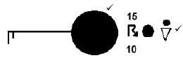 (Any ONE)
(2 x 1) (2)
2.3.5
- Backing ✔ (1 x 1) (1)
- The wind changes in an anti-clockwise direction in a system where the air movement is clockwise. ✔✔ (1 x 2) (2)
- During Monday the warm sector is dominated by North westerly winds driven by the westerly wind belt ✔✔
As the cold front moves over the area is dominated by the cold sector, with south westerly winds which is driven by the Polar easterlies ✔✔ (2 x 2) (4)
2.4
2.4.1 Direct short wave sunrays ✔ /Incoming solar radiation ✔ (CONCEPT) (1 x 1) (1)
2.4.2 Urban areas receive 13–17% less insolation. ✔✔ (1 x 2) (2)
2.4.3
- Insolation is less in urban areas because of more smoke, dust and pollution particles reflecting sunrays away from the surface. ✔✔
- The dust particles also limits terrestrial radiation ✔✔
- Artificial surfaces, artificial production of heat units, high buildings etc. either absorbs or creates more heat over the urban areas. ✔✔
(Any TWO) (2 x 2) (4)
2.4.4 Higher precipitation
- Urban areas have more condensation nuclei (dust and pollution particles) around which condensation occur. ✔✔
- Greater thermal convection due to heat island effect is causing higher rainfall. ✔✔
- When the wind hits the tall buildings it rises, cools off and condense to form clouds and eventually rainfall. ✔✔
Lower relative humidity
- Less vegetation over urban areas decreases the transpiration rate ✔✔
- Storm water drainage systems carries runoff away, therefore evaporation decreases ✔✔
(Any FOUR – MUST MAKE MENTION OF BOTH.) (4 x 2) (8)
2.5
2.5.1 Meander neck ✔ (1 x 1) (1)
2.5.2
- X – Erosion ✔
Y – Deposition ✔ (2 x 1) (2) -
- The river flows faster at the outer bank and is undercutting the area ✔✔
- Repetition of undercutting will eventually cause the top part of the bank to tumble ✔✔
- The bank will start to retreat ✔✔
(Any TWO) (2 x 2) (4)
2.5.3
- The river bend in STAGE 2 is very pronounced reducing the speed of the river, hence causing water to build-up because of the delay and will eventually overflow. ✔✔
- A straighter channel in STAGE 4 will increase the speed of the river, therefore no accumulation of water takes place. ✔✔ (2 x 2) (4)
2.5.4
- During heavy rainfall periods or flooding the river will cut through the neck of the meander. ✔✔
- Deposition next to the bank will eventually block off the meander completely. ✔✔ (2 x 2) (4)
2.6
2.6.1
- – Wind gap ✔
- – Elbow of capture ✔ (2 x 1) (2)
2.6.2
- Watershed ✔ (1 x 1) (1)
- Due to headward erosion the watershed will be removed or lowered ✔✔
River at D will eventually cut through the watershed due to headward erosion ✔✔
(Any ONE) (1 x 2) (2)
2.6.3 Transport routes can be constructed through the gap in the mountain, which was the result of river capture. This will shorten the distance to either side of the mountain. ✔✔ (1 x 2) (2)
2.6.4
- The environment will be negatively affected
- Biodiversity will be destroyed ✔✔
- Aquatic life will be reduced or will totally disappear ✔✔
- Ecosystems disturbed ✔✔
- Natural habitats will be destroyed ✔✔
- The river will eventually dry up if extensive periods of low rainfall occur ✔✔
- The water table will be lowered ✔✔
(Any FOUR) (4 x 2) (8)
[75]
QUESTION 3
3.1
3.1.1 Ribbon development ✔
3.1.2 CBD ✔
3.1.3 Regional shopping centre ✔
3.1.4 Isolated shops ✔
3.1.5 CBD ✔
3.1.6 Outlying business centre ✔
3.1.7 Neighbourhood shopping centre ✔ (7 x 1) (7)
3.2
3.2.1 Gross Domestic Product ✔
3.2.2 Informal sector ✔
3.2.3 Beneficiation ✔
3.2.4 Footloose ✔
3.2.5 Import replacement ✔
3.2.6 Food security ✔
3.2.7 Decentralisation ✔
3.2.8 Foreign Exchange ✔ (8 x 1) (8)
3.3
3.3.1 It is unifunctional because primary economic activities dominate ✔ (1 x 1) (1)
3.3.2 Isolated / Dispersed ✔ (1 x 1) (1)
3.3.3
- Relief
Hilly and mountainous areas influenced the isolated pattern. ✔✔ - Water availability
When water is readily and easy available it encourages dispersed settlements. ✔✔ (2 x 2) (4)
3.3.4
- Its extensive because a large area is being used for farming ✔✔
AND ANY ONE OF COMMERCIAL- It is commercial because outbuildings for the storage of either equipment or products can be identified ✔✔
- It is commercial because the farm area is divided into camps to reduce soil erosion ✔✔
[LEARNERS MUST REFER TO BOTH ASPECTS TO OBTAIN MAXIMUM MARKS.] (2 x 2) (4)
3.3.5
- Farmer can use his machinery extensively ✔✔
- The farmer does not need to share any of his equipment ✔✔
- The farmer’s land is not fragmented ✔✔
- The farmer decides on his own how he want to manage the farm ✔✔
- Makes his own decisions ✔✔
(Any TWO) (2 x 2) (4)
3.4
3.4.1 It is a situation on the public roads that occurs because of more vehicles than the road can handle. ✔ (Concept) (1 x 1) (1)
3.4.2
- Separation between residence and workplace ✔
- Commuter population
- Overconcentration of activities in the CBD of cities ✔
- Outdated street plan and pattern ✔
- Rapid urbanisation ✔
- Rural-urban migration ✔
(Any TWO) (2 x 1) (2)
3.4.3 If people used public transport it would decrease traffic congestion ✔✔ The driver expects others to use public transport when he himself is not ✔✔ (1 x 2) (2)
3.4.4
- Road rage / Frustration / Anger
(ANY NEGATIVE EMOTION) (1 x 1) (1) - Health problems like heart attacks, respiratory problems etc. may occur. ✔✔
Because of frustration more accidents may happen ✔✔
Conflict between drivers may result in violence ✔✔
(Any ONE) (1 x 2) (2)
3.4.5
- Building of ring roads around the congested area ✔✔
- Synchronised robots ✔✔
- One way streets ✔✔
- Subsidise public transport so that more people are encouraged to use it ✔✔
- Designated lanes for busses and other public transport services to encourage faster travelling ✔✔
- Use of flexitime for businesses to encourage different start and closing times to regulate the in- and outflow of traffic in the CBD ✔✔
- Encourage lift clubs ✔✔
- Park and ride schemes ✔✔
(Any FOUR) (4 x 2) (8)
3.5
3.5.1
- 2014 ✔ (1 x 1) (1)
- Construction ✔ (1 x 1) (1)
3.5.2
- Decrease ✔ (1 x 1) (1)
- 1,8% ✔ (1 x 1) (1)
- Negative growth rate because both the primary and secondary sectors experienced a huge (14%) negative growth rate ✔✔ compared to the 1,1% positive growth rate of the tertiary sector ✔✔ (2 x 2) (4)
3.5.3
- There might have been more imports than exports ✔✔
- Exports decreased because of decrease in primary and secondary production ✔✔
(Any ONE) (1 x 2) (2)
3.5.4 Food prices will increase and will affect the poorest the most ✔✔ Increased unemployment because of job losses directly linked to agriculture ✔✔ (2 x 2) (4)
3.6
3.6.1 Rooibos tea✔ (1 x 1) (1)
3.6.2
- Koeberg nuclear power plant (1 x 1) (1)
- Cheaper electricity is available if the industry is stationed near Koeberg ✔✔
Decreases production costs of goods ✔✔
Koeberg’s nuclear energy provides alternative energy as coal generated energy is expensive ✔✔
(Any ONE) (1 x 2) (2)
3.6.3
- The cold Benguela current is causing upwelling, bringing nutrients to the water surface ✔✔
- Increases phytoplankton and zooplankton which attracts larger fish ✔✔
- Fishing flourishes because of this upwelling ✔✔
- Huge shoals pass along the Cape coast ✔✔
(Any TWO) (2 x 2) (4)
3.6.4
- There is a lack or shortage of minerals ✔✔
- The region is very far from the power stations of Mpumalanga, making electricity very expensive despite Koeberg being in the region ✔✔
- Initial slow development caused lack of job opportunities for the fast growing population ✔✔
- High transport costs and the large distance to the Gauteng market places disadvantages the SW Cape compared to the other industrial regions ✔✔
- The availability of fresh water can become a problem in the future ✔✔ The region has not attracted new industries because salaries are generally lower, and the buying power of the growing population is reduced ✔✔
- Large, flat industrial sites are limited close to Cape Town, and therefore land is expensive ✔✔
- Many of the sites set aside for industrial use have been taken over by informal settlements ✔✔
(Any FOUR) (4 x 2) (8)
[75]
QUESTION 4
4.1
4.1.1 F (Specialisation) ✔
4.1.2 K (Rural depopulation) ✔
4.1.3 J (Rural-urban migration) ✔
4.1.4 E (Mechanisation) ✔
4.1.5 G (Market orientated) ✔
4.1.6 H (Push factors) ✔
4.1.7 A (Fragmentation) ✔
4.1.8 C (Consolidation) ✔ (8 x 1) (8)
4.2
4.2.1 A ✔
4.2.2 B ✔
4.2.3 A ✔
4.2.4 A ✔
4.2.5 B ✔
4.2.6 B ✔
4.2.7 A ✔ (7 x 1) (7)
4.3
4.3.1 The process of compensating people for the land they lost due to forced removals ✔ (Concept) (1 x 1) (1)
4.3.2
- To redress the injustices of apartheid ✔
- For national reconciliation and stability ✔
- To promote economic growth ✔
- To alleviate poverty ✔
(Any TWO) (2 x 1) (2)
4.3.3
- Beneficiaries have been neglected by the government ✔
- The people lack support to start ploughing ✔
- The people do not have the finances ✔ (3 x 1) (3)
4.3.4
- People were given land simply to redress the injustices of past policies, but no support to generate income and make an adequate and meaningful living ✔✔ (1 x 2) (2)
4.3.5
- Provide financial assistance to make sure that farmers can buy the basic equipment ✔✔
- Have workshops and training services available to make sure that the skills in farming and business management is on par ✔✔
- Help the farmers understand how the labour policies should be implemented ✔✔
- The development of local community forums so that the community can discuss how land should be developed and maintained ✔✔
- Provision of proper infrastructure like roads, electricity, computer literacy etc. ✔✔
- Government/NGO support ✔✔
(Any FOUR) (4 x 2) (8)
4.4
4.4.1 Rural-urban fringe ✔ (1 x 1) (1)
4.4.2 Area in the photo has mixed functions of rural and urban ✔ (1 x 1) (1)
4.4.3
- Land is cheaper ✔
- There is more space for further expansion ✔
- Factory will be near to raw materials ✔
- Close to labour force ✔
- Close to transport networks ✔
(Any TWO) (2 x 1) (2)
4.4.4
- The market is nearby so transport costs of products will decrease ✔✔
- The farmer has the advantages of the urban services, without paying for it ✔✔
- Demand/competition for land increases the land value ✔✔
(Any TWO) (2 x 2) (4)
4.4.5
- Rural areas and life will be destroyed and could result in a decrease in food production ✔✔
- Biodiversity and aesthetic appeal will be destroyed ✔✔
- The balance of climatic conditions may be destroyed ✔✔
- Informal settlements may develop, which can increase the social and economic problems in the area ✔✔
- To prevent neighbouring towns from merging into one another ✔✔
- To preserve the special character of historic rural life ✔✔
(Any THREE) (3 x 2) (6)
4.5
4.5.1 When raw materials are being transformed into finished goods on a large scale/Add value to an article ✔ (Concept) (1 x 1) (1)
4.5.2 Secondary sector ✔ (1 x 1) (1)
4.5.3
- Employment creation ✔
- Economic empowerment ✔
(Any ONE) (1 x 1) (1)
4.5.4
- Upgrading of skills and knowledge in the production of manufactured goods ✔✔
- More beneficiation of raw materials improving the quality of manufactured goods ✔✔
- Foreign exchange can be earned ✔✔
- Creation of higher paid employment opportunities ✔✔
(Any TWO) (2 x 2) (4)
4.5.5 Labour supply
- South Africa consists of a very large unschooled labour force, with very few entrepreneurs ✔✔
- Production per worker in South Africa is very low ✔✔
- Strikes and stay away actions for higher wages and salaries hinders production ✔✔
International competition
- South Africa finds it very difficult to compete against countries like China, which produces low cost products ✔✔
- South Africa in some instances has had to implement trade restrictions in order to protect local markets, which hinders trade relationships ✔✔
(Any FOUR)
[LEARNER MUST MENTION AT LEAST ONE FACT FROM LABOUR SUPPLY OR INTERNATIONAL COMPETITION.] (4 x 2) (8)
4.6
4.6.1 It is an integrated network of infrastructure within a geographical area designated to stimulate economic development and growth ✔ (Concept) (1 x 1) (1)
4.6.2 Swaziland ✔ (1 x 1) (1)
4.6.3
- Maputo is the nearest export harbour to Johannesburg ✔
- To strengthen relationships between South Africa and Mozambique ✔
(Any ONE) (1 x 1) (1)
4.6.4 The upgrading of infrastructure made it easier to visit major tourist destinations along the corridor ✔✔ (1 x 2) (2)
4.6.5
- To rehabilitate the core infrastructure along the corridor ✔✔
- To maximise investment with the corridor area ✔✔
- To ensure development in previously disadvantaged communities ✔✔
- To promote sustainable job creation for people living in underdeveloped areas along the corridor ✔✔
[Any THREE] (3 x 2) (6)
4.6.6
- A large bulk of the coal mined in Mpumalanga is exported to the Maputo harbour ✔✔
- The corridor passes through vast primary and industrial production areas ✔✔
- Mpumalanga has many international tourist destinations through which the corridor passes ✔✔
- The largest national conservation area, the National Kruger Park can also be found along the corridor ✔✔
(Any TWO) (2 x 2) (4)
[75]
GRAND TOTAL: 225