ElimuZA Access to Education
GEOGRAPHY PAPER 1 GRADE 12 ANNEXURE - AMENDED SENIOR CERTIFICATE EXAM AND PAST PAPERS MAY/JUNE 2016
Share via Whatsapp Join our WhatsApp Group Join our Telegram GroupGEOGRAPHY PAPER 1
GRADE 12
SENIOR CERTIFICATE EXAMINATIONS
2016
ANNEXURE
FIGURE 1.1: SYNOPTIC WEATHER MAP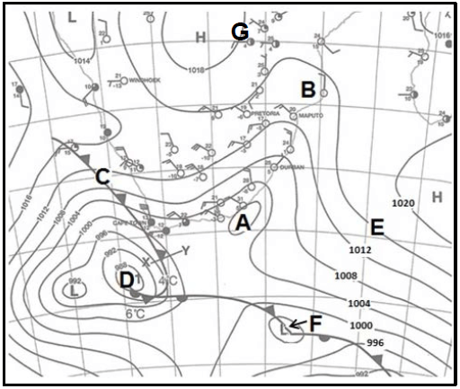
FIGURE 1.3: PASSAGE OF A TYPHOON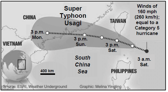
FIGURE 1.4: TEMPERATURE INVERSION IN A VALLEY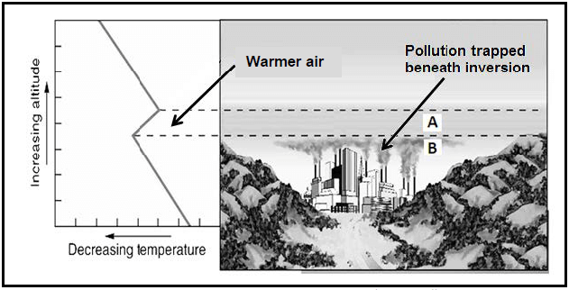
FIGURE 1.5: STREAM PIRACY/RIVER CAPTURE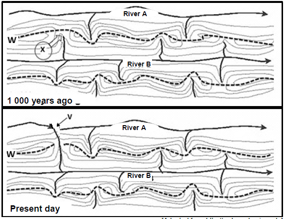
FIGURE 1.6: IMPACT OF PEOPLE ON RIVERS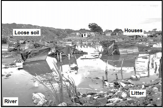
FIGURE 2.1: STAGES IN THE DEVELOPMENT OF A MID-LATITUDE CYCLONE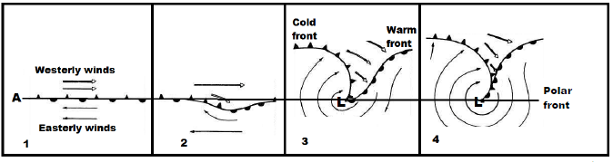
FIGURE 2.3: SLOPE WINDS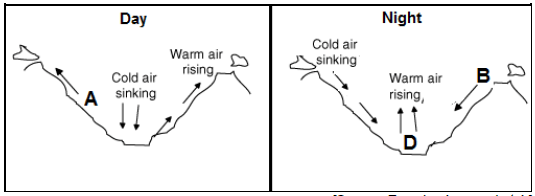
FIGURE 2.4: DIMENSIONS OF AN URBAN HEAT ISLAND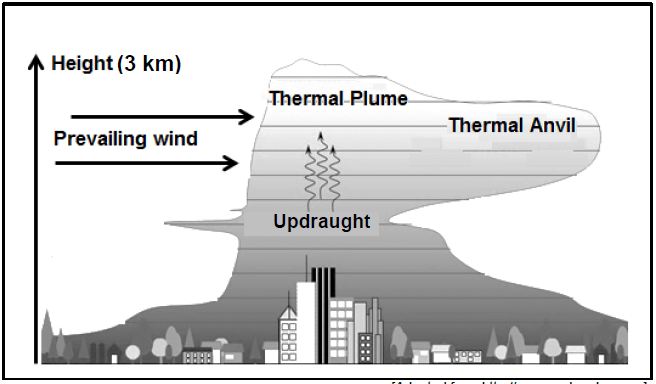
FIGURE 2.5: DRAINAGE BASIN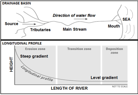
FIGURE 2.6: FORMATION OF A LEVEE
FIGURE 3.3: URBAN EXPANSION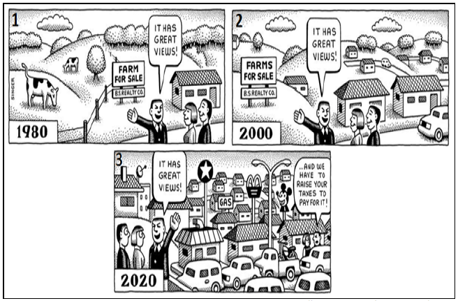
FIGURE 3.4: SHAPE AND LAYOUT OF BANGKOK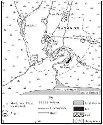
FIGURE 3.5: SUGAR CANE FARMING
| Sugar cane is grown along the KwaZulu-Natal coast due to the ideal climatic conditions in this area. The industry is composed of 15 sugar mills, 13 of which are scattered from the southern border of KwaZulu-Natal to its northern border. Most of the sugar cane supplied to these mills (85%) is produced by over 53 000 registered cane growers, the balance being supplied by the mill estates. The production of sugar cane on communally held land has expanded significantly over the past 25 years. Many sugar mills are located right next to a main arterial route. |
FIGURE 3.6: CORE INDUSTRIAL REGIONS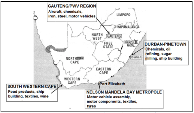
FIGURE 4.3: A COUNTRY VILLAGE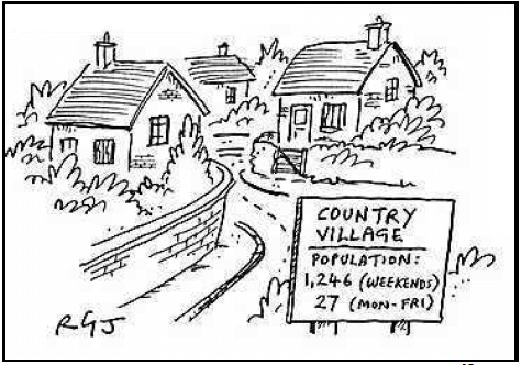
FIGURE 4.4: AN INFORMAL SETTLEMENT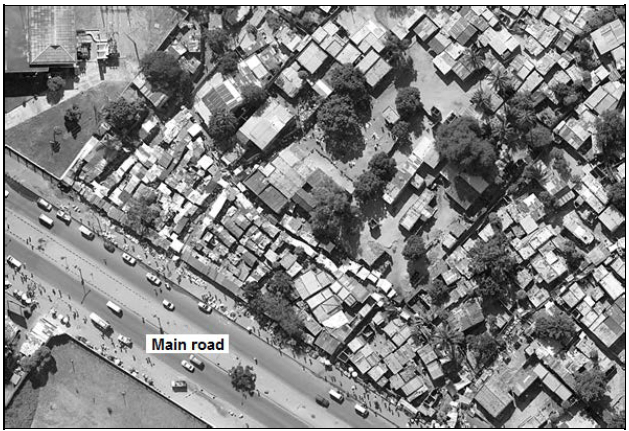
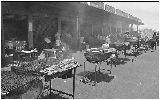
FIGURE 4.5: LUNCHTIME TRADING