ElimuZA Access to Education
GEOGRAPHY PAPER 1 GRADE 12 ANNEXURE - PAST PAPERS 2017 JUNE
Share via Whatsapp Join our WhatsApp Group Join our Telegram GroupGEOGRAPHY PAPER 1
GRADE 12
NATIONAL SENIOR CERTIFICATE
ANNEXURE
JUNE 2017
FIGURE 1.2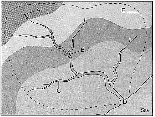
FIGURE 1.3: MATURE STAGE OF A MID-LATITUDE CYCLONE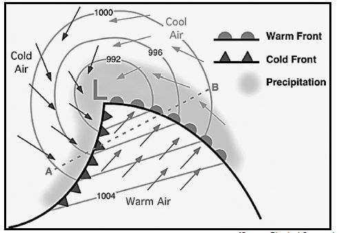
FIGURE 1.4: WEATHER OF SOUTH AFRICA
FIGURE 1.5: FLUVIAL LANDFORMS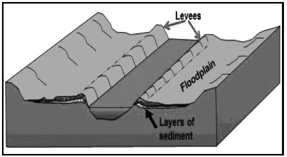
FIGURE 1.6: EXTRACT BASED ON RIVER CATCHMENT AREA IN SOUTH AFRICA
| The Buffalo River flows from the Amatola Mountains of the Eastern Cape. It flows eastward over the coastal plateau before entering the Indian Ocean at East London harbour. The Buffalo River’s catchment area of 1 287 km2 supports a population of 570 000 inhabitants with a population density of 440 people per km2. Dense urban and rural settlements are found along the course of the river. Urban and industrial areas take up approximately 12% of the catchment area, while subsistence farming is predominant. Four dams in the river provide water to the main urban areas of King William’s Town, Zwelitsha, Mdantsane and East London. |
FIGURE 2.1:
TEMPERATURE DIFFERENCES BETWEEN RURAL AND URBAN AREAS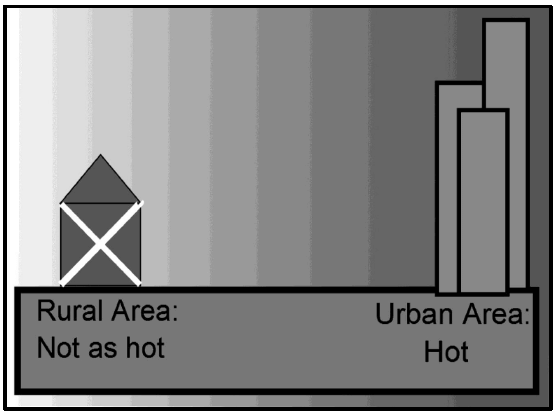
FIGURE 2.3: TROPICAL CYCLONE DINEO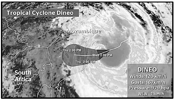
FIGURE 2.4: CUT OFF LOW PRESSURE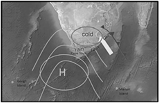
FIGURE 2.5: DRAINAGE PATTERNS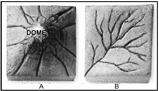
FIGURE 2.6: LONGITUDINAL AND CROSS PROFILES OF A TYPICAL RIVER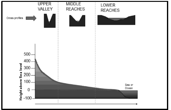
FIGURE 3.3: TRENDS IN URBAN AND RURAL POPULATION OF THE WORLD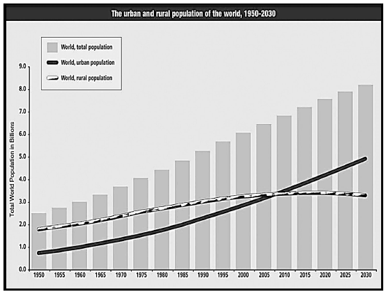
FIGURE 3.4: ISSUE OF LAND REDISTRIBUTION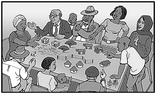
FIGURE 3.5: PLANNED REGIONAL SHOPPING CENTRE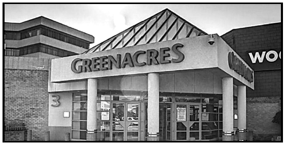
FIGURE 3.6: ISSUES RELATED TO RAPID URBANISATION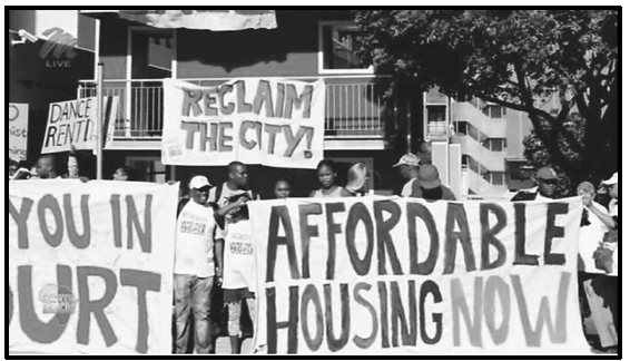
Published in 2017 Grade 12 June Exams